Randonnée Marche La Chaudière - Les 3 Becs - Photo
 Noiraude
Noiraude

Utilisateur

© OpenStreetMap contributors
Longueur
Longueur
10,3 km
Altitude max
Altitude max
1553 m
Dénivelé positif
Dénivelé positif
816 m
Km-Effort
Km-Effort  
21 km
Altitude min
Altitude min
1017 m
Dénivelé négatif
Dénivelé négatif
815 m
Boucle
Boucle
Oui
Date de création :
2014-12-10 00:00:00.0
Dernière modification :
2014-12-10 00:00:00.0

(1 Avis)

Marche
Marche
5h37
Difficulté : Moyen

Scannez ce code QR pour ouvrir la randonnée dans l'application SityTrail

Application GPS de randonnée GRATUITE

Logo SityTrail SityTrail

IGN / Instituts géographiques

Télécharger SityTrail sur l'App Store Télécharger SityTrail sur Google Play

Logo SityTrail SityTrail World

Le monde est à vous

Télécharger SityTrail sur l'App Store Télécharger SityTrail sur Google Play Télécharger SityTrail sur Huawei AppGallery

À propos

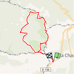
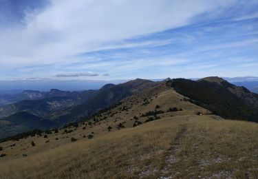
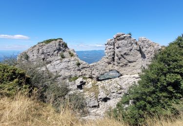
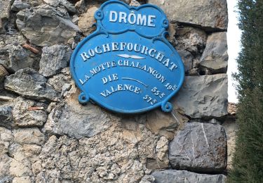
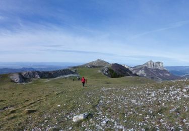
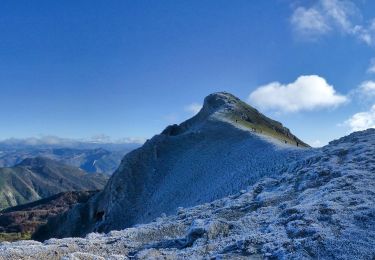
Randonnée Marche de 10,3 km à découvrir à Auvergne-Rhône-Alpes, Drôme, La Chaudière. Cette randonnée est proposée par Noiraude.
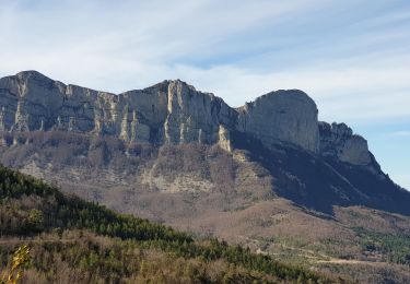
Description

Boucle des 3 Becs

Profil altimétrique

Photos

Localisation

Pays :
France
Région :
Auvergne-Rhône-Alpes
Département/Province :
Drôme
Commune :
La Chaudière
Localité :
Unknown
Départ:(Dec)
Départ:(UTM)
674888 ; 4944128 (31T) N.

Commentaires

Veuillez vous connecter pour laisser un commentaire ou une note


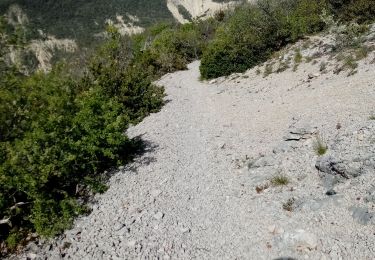
Très belle randonnée, le chemin récemment restauré est maintenant très agréable et praticable.Attention, depuis 2011, les chiens ne sont pas autorisés (même en laisse).


Randonnées à proximité

Randonnée Marche Bourdeaux - Chemin des protestants- Bourdaux - Photo
Marche
crocau

Marche

Moyen
(1)
Bourdeaux, Auvergne-Rhône-Alpes, Drôme, France
7,9 km | 11,2 km-effort
2h 48min
Oui
Randonnée Marche La Chaudière - La chaudiere - chapelle des Sadoux - Photo
Marche
bob2023

Marche

Très facile
(2)
La Chaudière, Auvergne-Rhône-Alpes, Drôme, France
11,1 km | 18,2 km-effort
3h 47min
Oui
Randonnée Marche La Chaudière - les trois becs - Photo
Marche
GUIDE
amiral13

Marche

Moyen
La Chaudière, Auvergne-Rhône-Alpes, Drôme, France
11,7 km | 23 km-effort
6h 25min
Oui
Randonnée Marche Rochefourchat - Serre Délégué depuis Rochefourchat 15 10 23 - Photo
Marche
bymarc26

Marche

Moyen
Rochefourchat, Auvergne-Rhône-Alpes, Drôme, France
14,3 km | 25 km-effort
4h 29min
Oui
Randonnée Marche La Chaudière - 070823 Boucle des 3 Becs - Photo
Marche
mzonzon05

Marche

Très difficile
La Chaudière, Auvergne-Rhône-Alpes, Drôme, France
11,4 km | 23 km-effort
4h 58min
Oui
Randonnée Marche Bézaudun-sur-Bîne - Fonderesse - Photo
Marche
AIGUIER

Marche

Difficile
Bézaudun-sur-Bîne, Auvergne-Rhône-Alpes, Drôme, France
13,8 km | 22 km-effort
27h 34min
Oui
Randonnée Marche Rochefourchat - Grand Delmas depuis Rochefourchat - Photo
Marche
ajd26

Marche

Moyen
Rochefourchat, Auvergne-Rhône-Alpes, Drôme, France
16,6 km | 28 km-effort
5h 25min
Oui
Randonnée Marche Rochefourchat - Rochefourchat (ASPTT) - Photo
Marche
TOULAUDIN

Marche

Moyen
Rochefourchat, Auvergne-Rhône-Alpes, Drôme, France
14 km | 25 km-effort
5h 42min
Oui
Randonnée Marche Bézaudun-sur-Bîne - le grand Delmas (AS) - Photo
Marche
TOULAUDIN

Marche

Difficile
Bézaudun-sur-Bîne, Auvergne-Rhône-Alpes, Drôme, France
16,9 km | 29 km-effort
6h 16min
Oui


Fermer
Mes abonnements